
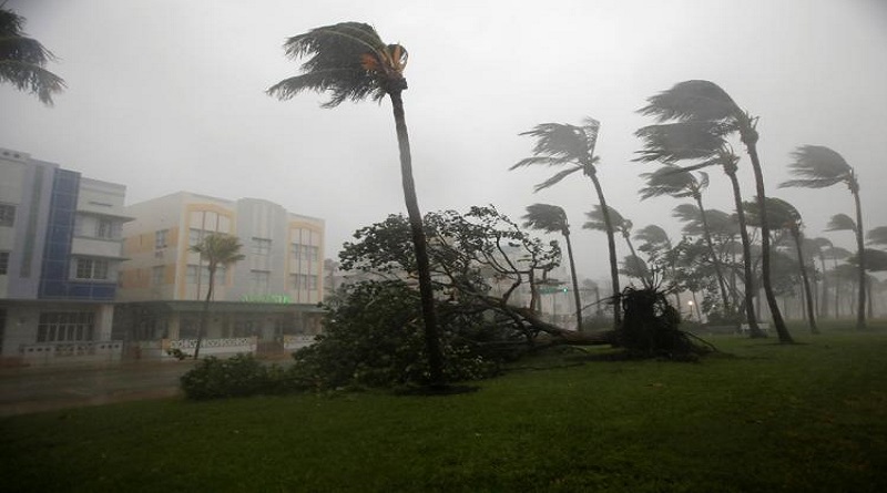
Hurricane Irma battering Florida Peninsula, with ‘catastrophic’ storm surge feared
Extremely dangerous Hurricane Irma first crashed into the Florida Keys on Sunday morning and then made a second landfall on Marco Island on Florida’s west coast Sunday afternoon, unleashing violent wind gusts up to 142 mph and storm-surge flooding . As the vicious storm scoots up Florida’s west coast into this evening, forecasters fear that this storm will go down as one of the worst in the state’s history.
At 8 p.m., the storm was centered 15 miles east-northeast of Fort Myers. Its eyewall – containing the storm’s most violent winds, was entering Port Charlotte. The storm centre was headed north at 14 mph toward Sarasota and Tampa, where winds of 75 to 100 mph were expected to arrive later between about 9 p.m. and midnight, south to north.
Ocean levels were rising quickly in Southwest Florida as the storm centre lifted north. In Naples, the storm surge raised water levels 8 feet in two hours, between about 4:30 and 6:30 p.m.
Irma’s peak winds of 105 mph, with higher gusts, had dropped 20 mph from the morning, making it a Category 2 hurricane (down from a Category 4). Even with slow weakening likely to continue as the storm passes over land, Irma remains very serious and life-threatening. The National Hurricane Center said it is expected to remain a hurricane through Monday morning.
Coastal waters could rise 10 to 15 feet above normally dry land in sections of Southwest Florida, inundating homes, businesses and roads, an “imminent danger,” according to the Hurricane Center.
When Irma crashed into the Keys early Sunday as a Category 4, following Hurricane Harvey’s assault in Texas, it marked the first time on record that two Category 4 storms had made landfall in the United States in the same year.
Because of the storm’s magnitude, the entire state of Florida is being severely affected by damaging winds and torrential rains. Tropical storm and hurricane conditions were also predicted to spread into the Florida Panhandle, eastern Alabama, much of Georgia and southern South Carolina by Monday.
Irma’s eyewall passed through Fort Myers and Cape Coral just before 7 p.m., producing wind gusts of 88 and 101 mph and was moving into Port Charlotte at 8 p.m., which could expect gusts in this range through 9 p.m.
As the eyewall moved over Naples late Sunday afternoon, it reported sustained winds of 93 mph and a gust to 142 mph – the strongest recorded from this storm in the U.S.
Josh Morgerman, a hurricane chaser positioned in Naples, described the scene: “Went thru violent, destructive winds. Screaming, whiteout, wreckage blowing by in fog.” Then the calm eye moved overhead.
Washington Post